How can one of Europe’s largest coal-fired power stations be transformed into a forward-looking industrial site?
Kraftwerk Frimmersdorf
De Zwarte Hond has developed an urban design plan for the Frimmersdorf power plant. With its exceptional location in Germany’s Rhineland mining region, close to the metropolitan areas of Düsseldorf and Cologne, its proximity to the Erft nature reserve and its distinctive architecture, Frimmersdorf is a unique place for sustainable, forward-looking area development in Europe. Today, the former power plant impresses with its enormous scale and spatial quality. Long, straight roads and imposing industrial buildings engage in an exciting spatial interplay. Although much of the technical infrastructure is being dismantled, the future digital business park will remain a special place thanks to the interplay between openness and monumentality, and between old and new. The urban framework divides the site into five sub-areas, which differ in terms of development phases, scale, potential functions, and the presence of monumental buildings and structures. The power plant building, with its 550-metre-long machine hall, forms the starting point for urban development and encompasses the central blocks A to N. From a heritage perspective, blocks A to D are particularly valuable as they exemplify the early development of coal-based industrial energy generation. Alongside these well-preserved areas, the focus is on highlighting the ‘Coal Route’. This urban planning concept was supported by the German Federal Ministry for Economic Affairs and Climate Action, Starke Projekte GmbH and the state of North Rhine-Westphalia.
data
- Location
- Grevenbroich, DE
- Size
- 68 ha
- Client
- Stadt Grevenbroich, Starke projekte GmbH
- Discipline
- Research, Urban Design
- Program
- Offices, Retail, Urbanization Strategy, Master Planning
- Period
- 2023-2024
- Status
- In Development, Vision
- Photography
- Onur Can tepe
- themes

Frimmersdorf

Kraftwerk

1925/26: Construction of the Frimmersdorf I power plant by AEG with a planned capacity of 60 MW. © RWE Photo Archive

1953: Construction of Frimmersdorf II, a successor plant comprising two units (2×100 MW). © RWE Photo Archive
The Frimmersdorf power plant and the Rhineland mining region
With coal being phased out by 2030, the Rhineland mining region is undergoing a radical transformation. The Frimmersdorf, Neurath and Niederaußem power stations, the Garzweiler developments and numerous former mining sites define the region’s character, while simultaneously forming the heart of its transition. The now-closed [MOU5.1]Frimmersdorf plant, once one of the largest coal-fired power stations in Europe, plays a special role in this process.
In the coming years, the region’s landscape and economic value chains will change radically. Rather than relying on a single dominant economic sector, the region is embracing new functions, actors, and forms of value creation. In the coming years, the now-closed Frimmersdorf plant will be transformed into a forward-looking business location, playing a key role in the region’s structural transformation.


The Coal Route
The Frimmersdorf power plant is more than just a location; it is a landscape with a layered history and a complex interplay of functions. Waste heaps, open-pit mines, chimneys and cooling towers are still typical of the Rhineland lignite region, where infrastructure, production processes and the landscape are inextricably linked.
The Coal Route gives this place its spatial structure. From the Garzweiler mine, a three-kilometre-long conveyor belt ran to coal bunkers I and II, ensuring a continuous supply to the power plant. A second conveyor belt then transported the coal to the boiler houses, where it was burned to drive turbines weighing up to 130 tonnes. In this way, Frimmersdorf produced enough electricity for up to two million people.
Now, however, this landscape is undergoing a fundamental change. Cooling towers are disappearing, machine halls are being partially demolished and former mines are being flooded to create large lakes. What remains are robust structures and easily accessible sites and a place with a powerful history.

View of a decommissioned power plant

Decommissioned cooling towers

Long, straight existing roads

Coal bunker

Interior of the hall

Existing vegetation

Powerplant frimmersdorf today

Minister Scharrenbach and project partners present the future vision for Frimmersdorf Power Plant.
9 Development Goals
The analysis formed the basis for targeted discussions with the relevant departments, stakeholders, designers and political decision-makers, covering various themes and scales. Nine development goals were formulated to guide the area’s transformation. Together, these goals form a robust yet flexible framework that can respond to various market issues and development scenarios. The spatial structural plan translates these goals into specific sub-areas, building plots and public spaces.


Structural concept
Structural plan
The site impresses spatially with its enormous openness and the exceptional scale of its industrial buildings and technical installations. The long, straight roads and imposing industrial buildings create an exciting interplay of spaces. While many of the technical installations are being dismantled, the future digital business park will retain a unique character thanks to the interplay between openness and monumentality, and between old and new.
The urban planning framework divides the site into five sub-areas which differ in terms of development phases, potential functions, scale and the presence of monumental buildings and structures.
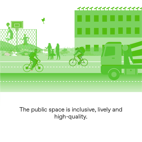
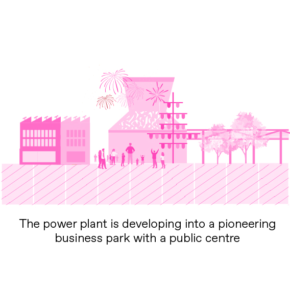
Identity-forming multifunctional public centre
The six cooling towers, the ash settling basins, the cooling water pump building, the 50-metre-high blocks and the existing pipeline routes form an impressive backdrop to a vibrant public centre with supra-regional appeal.
The areas surrounding the existing structures and buildings, as well as the adjacent new construction, will accommodate a variety of public and private functions. Here, the future meets industrial heritage. Autonomous shuttles will transport visitors and employees around the site. The public centre offers spaces for events, lunch breaks and after-work gatherings in an industrial historical setting.

2024

2025-2028

2030

2035+
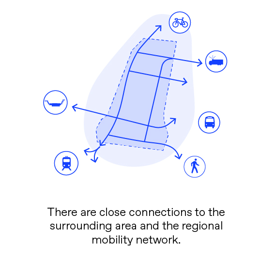
Five sub-areas
The northern, western and eastern zones are due to be remodelled from 2025 onwards, with the aim of them being ready for use again by 2030. A new data centre is under construction in the northern (XL) zone. To the south of this is a landscape park, which will form a green connection between the Erft and the Vollrather Höhe.
Several monumental buildings and structures will be preserved in the western zone. The existing structures in the central area, which are of great heritage value, will form its public heart in the future. The surrounding zones will accommodate both public and private functions. The heritage path, created by the LVR, reveals the history of the Coal Route. The western zone also offers large-scale, flexible development areas (M–L) and smaller plots along the Erft floodplains (S).
The power plant building will be preserved and given a new purpose. IT.NRW is opening a data centre in part of the building, while the machine hall is being developed into a workspace for the digital sector. Additional data centres can be located on the sites of the former boiler houses next door.
The eastern zone will serve as a support area, with parking facilities and mobility hubs located close to the power plant building. In the southern area, RWE is expected to remain partially operational until the early 2030s. The existing halls will be preserved and will continue to accommodate various user groups.


