How can a city centre benefit from seaside tourism?
Wilhelmshaven: Green-blue connecting routes
Since its foundation, Wilhelmshaven in German has referred to itself as ‘the green city by the sea.’ In particular, the two hubs at the Südstrand (South Beach) and in the city centre, attract large numbers of people. While tourists flock to the Südstrand, however, the area around the station is struggling with increasing vacancy. How can both areas reinforce each other? Commissioned by Wirtschaft Wilhelmshaven, an organization whose shareholders are the City of Wilhelmshaven and the Jade e.V. economic development association, De Zwarte Hond has developed a strategic vision for the future of Wilhelmshaven. A key question in the analysis was how different user groups move through the city. Tourists want to reach the water as quickly as possible, heading straight to the harbour or the sea. Residents, on the other hand, who know their city well, want to get from A to B quickly and more often choose a direct, less spectacular route through the Südstadt area. These various movement patterns have been translated into distinctive working models: a cultural-historical axis emphasizes the qualities of the Südstadt and the harbour as the centre, while a green ring emphasizes open spaces as a green belt. The models served to clarify qualities, stimulate discussion and determine strategic development directions. The interplay between them resulted in a vision plan that focuses on the Großer Hafen (harbour) and the Südstadt area as important links between city and sea. The plan’s package of measures for the coming years, such as the creation of a maritime passage and programmes to activate the harbour quay, will transform movement into an experience, strengthening the identity of Wilhelmshaven as a green, liveable coastal city.
data
- Location
- Wilhelmshaven, DE
- Size
- 210 ha
- Client
- Wirtschaftsförderungsgesellschaft Wilhelmshaven
- Discipline
- Research, Urban Design
- Program
- Urbanization Strategy, Master Planning, Design Research
- Period
- 2026
- Status
- Completed, Vision


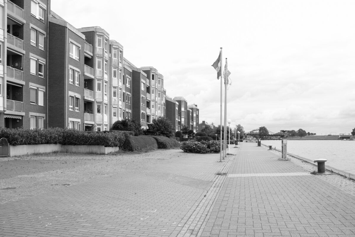
Numerous spatial barriers block access to the water

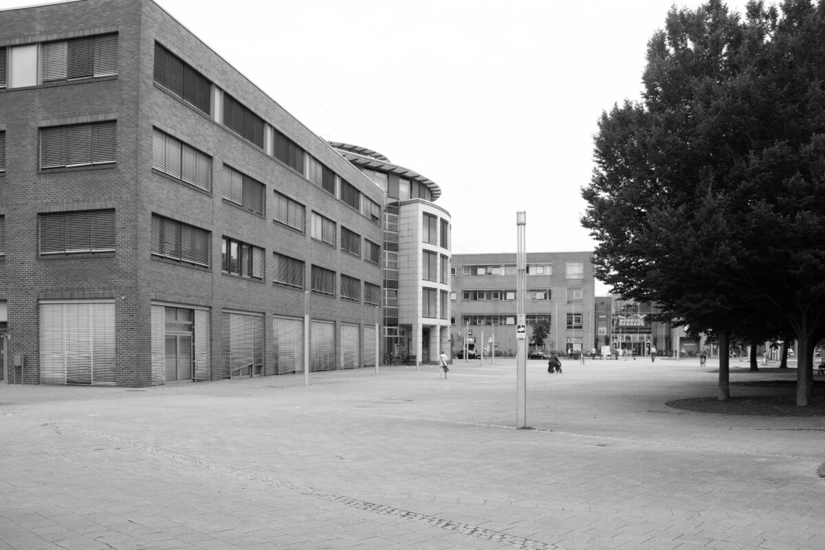
Valoisplatz: the city centre is characterized by a high degree of paving
Current dynamics and bottlenecks
Although Wilhelmshaven boasts attractive features such as its Gründerzeit architecture, its location within the Wadden Sea National Park and an abundance of green spaces, many tourists focus exclusively on the harbour museum area, avoiding the city centre altogether. This is partly due to a lack of lively amenities which has caused the centre’s public spaces to lose their quality.
The central Valoisplatz and the harbour promenade are two examples of this. Increasing vacancy in ground-floor spaces, numerous vacant plots and the high incidence of individual motorized vehicles, as well as a tight municipal budget, all exacerbate the functional and spatial deterioration of public spaces. This ensures that visitors and potential passers-by stay away, even though they are precisely the people who could contribute to the city centre’s vibrancy.

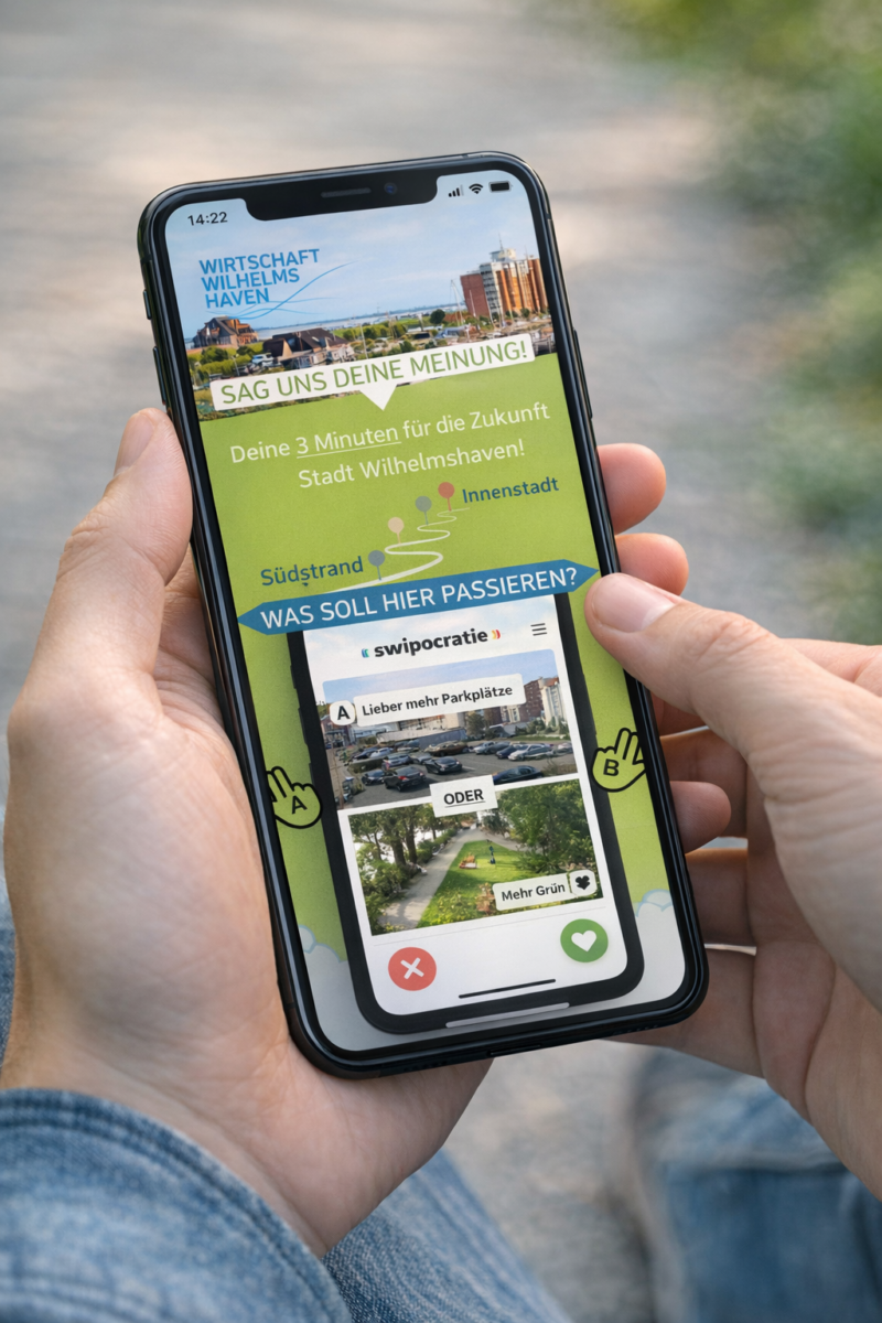
Surveying opinions with Swipocratie
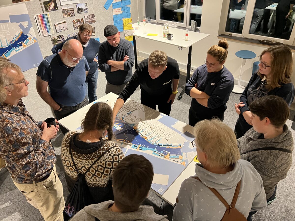
Discussing the working models in a workshop with residents, city councillors and politicians

Which ideas are the most popular?
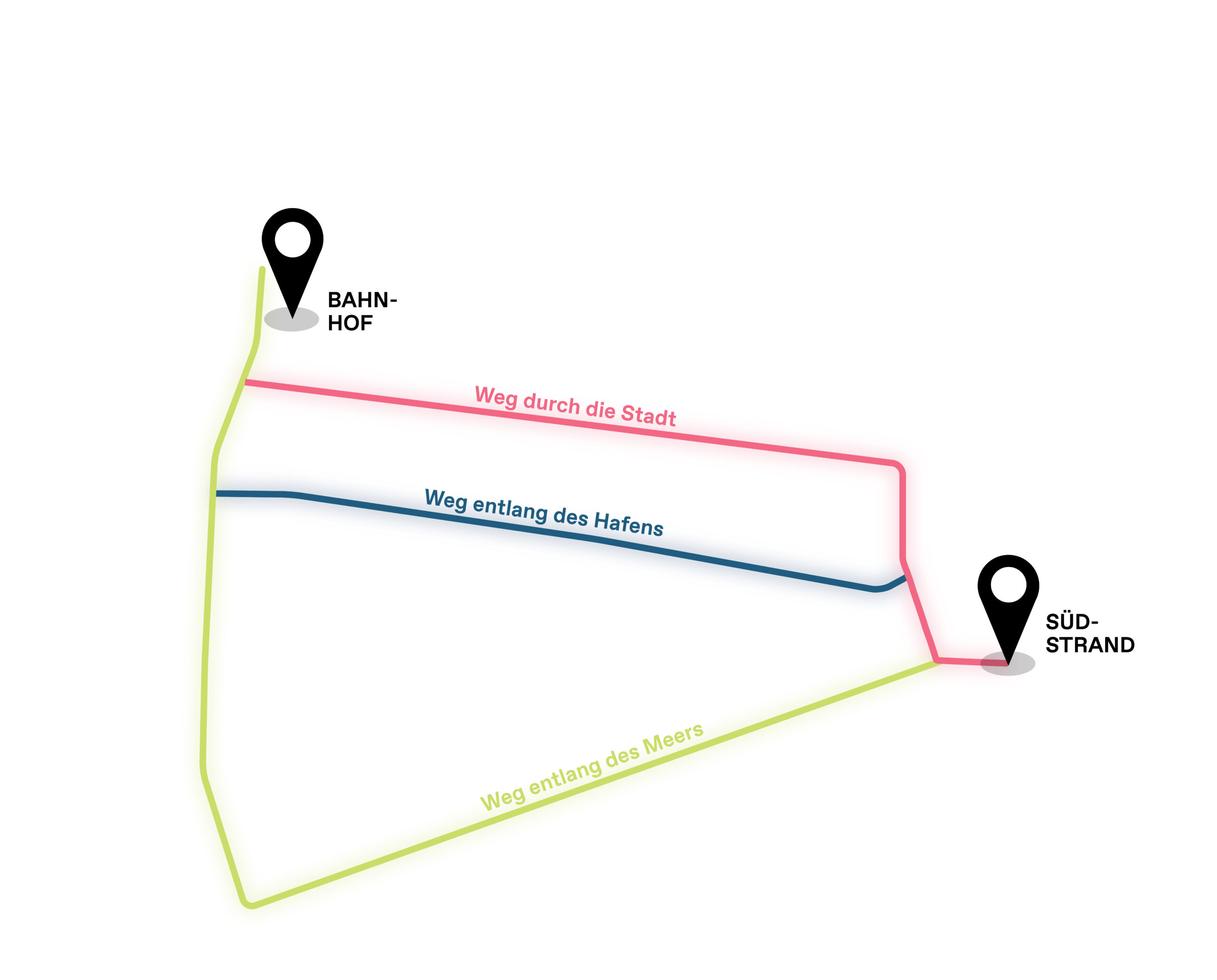
There is not one route, but three
Participatory process on the way to the vision plan
An extensive participatory process guided the development of the vision plan. Initially, a broad overview of opinions was gathered via the Swipocratie app. More than 2,600 participants were asked where they like to spend time, how they get around, and what they want for the city.
This revealed that people with different needs use different routes. Each route has its own thematic focus, resulting in the development of three working models that together cover the full spectrum.
For each model, a specific type of route was developed: a direct route, a recreational route and a maritime route. These models were then discussed in a workshop with residents, the municipality and politicians. Elements distilled from these models form the basis for the final vision plan.
The Cultural-Historical Axis Working Model
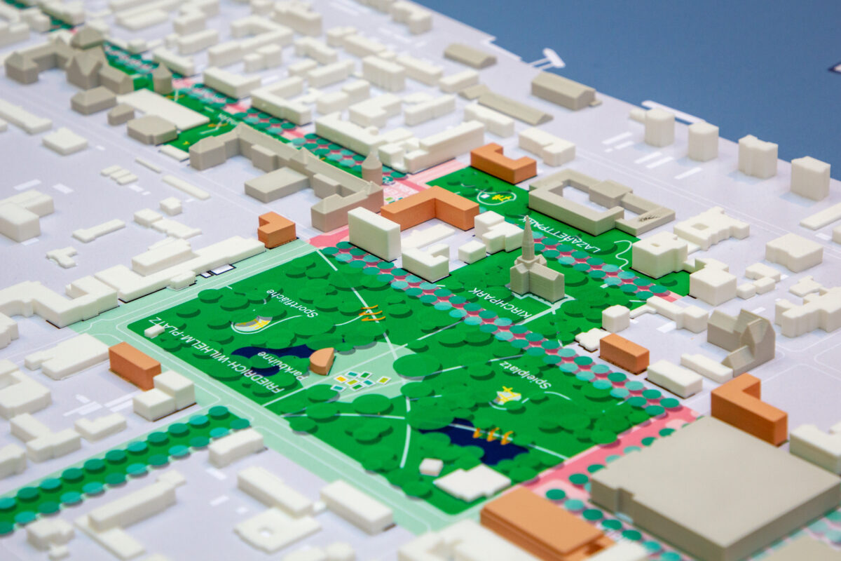
The Green Ring Working Model
The Harbour as Centre Working Model
A vision plan for better connections
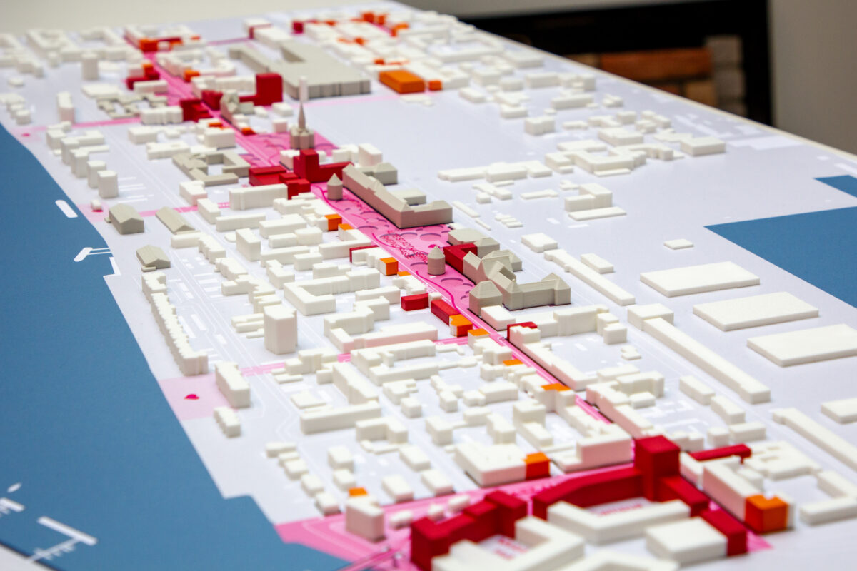
The vision plan sets out a long-term master plan to strengthen the spatial, functional and atmospheric links between the city centre and the Südstrand. It combines the key themes and objectives from the three extensively discussed working models – the Cultural-Historical Axis, the Harbour as Centre and the Green Ring – weighing them against each other to formulate a shared vision for the future. At its core is a system of multiple thematic routes, each with its own character and quality of experience, connecting important places in the city and leading to the water.
The resulting vision plan positions the Großer Hafen and the Südstadt as natural links between the city and the sea, translating strategic insight into a coherent set of interventions. These include a maritime passage and a vibrant programme along the harbour quay. This will make the sea more tangible in the city, transform movement into experience, and strengthen the identity of Wilhelmshaven as a green, liveable coastal city.
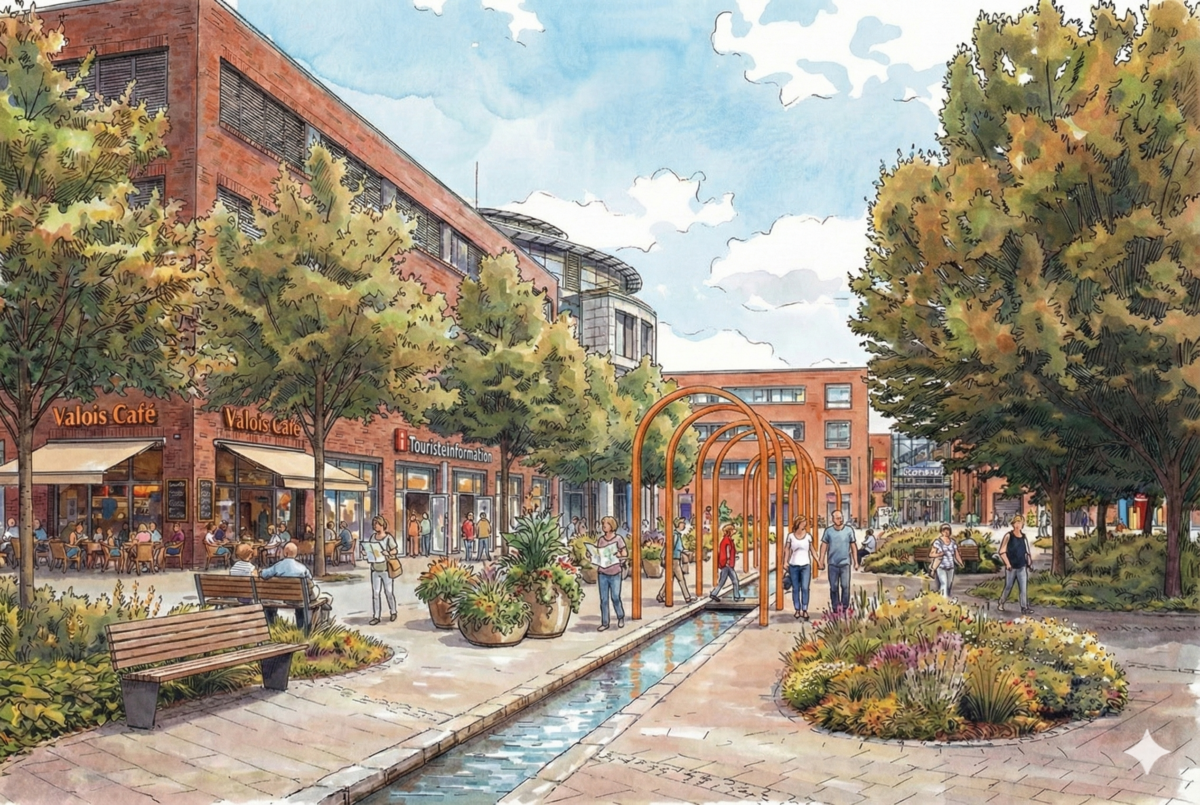
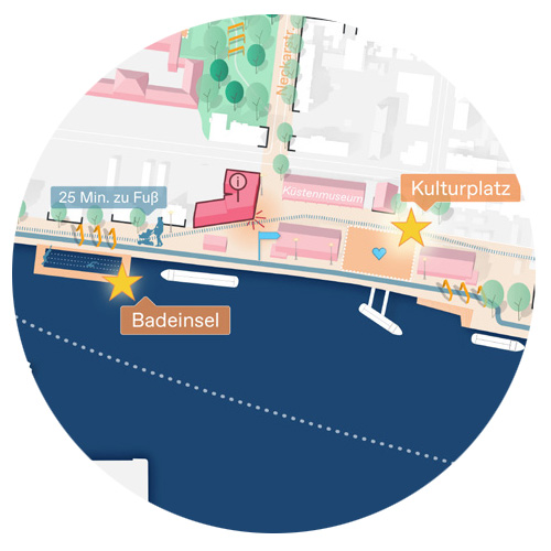
What might Valoisplatz look like in the future?
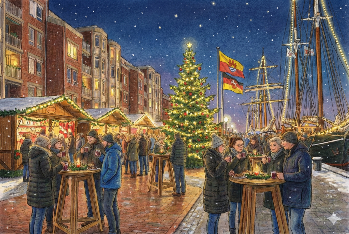
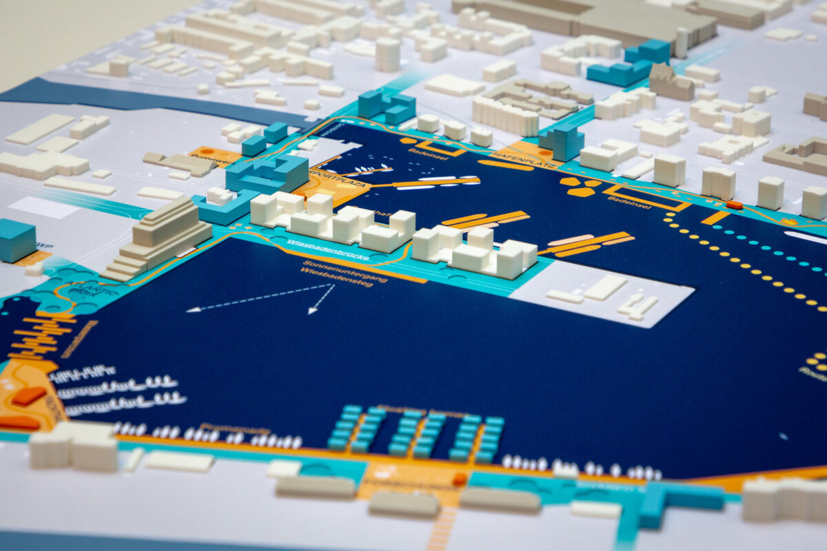
What might Bontekai look like in the future?
Spatial and functional strengthening of links
Programming along the harbour edge to activate and attract
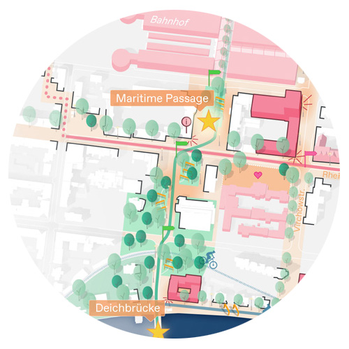
Leading visitors directly to the water via a maritime passage

Developing the Südzentrale area into an urban hub

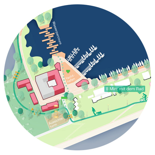
Activating and utilizing the Großer Hafen for living on the water
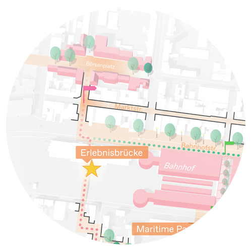
Connecting the abandoned Börsenplatz in the city centre to an axis leading towards the water


